The 2014 season of the Wadi Arabah’ Earthquake Project (WAEP), in the field from 29 December 2013 to 16 January 2014, was extremely successful. Our excavations at Qasr et-Tilah revealed important new evidence relating to every one of our pre-excavation goals. The Qasr et-Tilah site, located in the Wadi ‘Araba just south of the Dead Sea, lies along the main ancient routes connecting the Dead Sea and its agricultural and mineral resources westward to the Byzantine population centers in the Negev and from there to the rest of the Mediterranean world. This multi-period site, with its architectural ruins from the Nabataean through the early Islamic periods, also lies directly across the alignment of the Dead Sea Transform fault, and the extant architecture reveals significant damage and repair related to past earthquakes. Ruins at the site include the remains of a Late Roman quadriburgium (named “Toloha” in the Notitia Dignitatum) and a late Byzantine reservoir; abundant Nabataean and Byzantine pottery attest to occupation at the site through those periods as well. The majority of the radiocarbon dates from excavation at the site are to the sixth to seventh century, also attesting to the importance of this site in the Byzantine transition period. The site contains an extensive multi-period aqueduct system, and an agricultural field system consisting of interconnecting field walls, irrigation channels, and aqueducts.
A major focus for this project was to probe the fort to clarify the history of this structure. To this end, we excavated a trench that encompassed both the outside wall of the fort and the alignment of an underlying structure, thought to be Nabataean in age. This trench revealed collapsed layers relating to the fort, as well as evidence for the reuse of the ruins of the fort. This reuse included ash deposits, which provided charcoal for radiocarbon dates. Both ceramic and absolute dating will greatly clarify the earthquake and cultural history of the site.
The second goal for this season was to gain insight into the different phases of the water management systems at Qasr et-Tilah. Several trenches were excavated. A trench dug at the bottom of the main, northern water reservoir at the site revealed several sediment layers, indicating periods of reservoir fill and desiccation above a major plastered floor. This floor rested on a subfloor of large mortared boulders nearly one meter thick. Below was another anthropogenic surface that rests on the conglomeratic bedrock. Samples were collected at each level for radiocarbon analyses, which will finally allow for earlier phases of this structure to be dated.
Second, we excavated three trenches along the alignment of a previously unexplored aqueduct leading toward this main reservoir. These trenches revealed the first firm evidence for a covered aqueduct and provide evidence for the siting of an earlier reservoir beneath the extant one.
Third, we excavated a trench across the exterior wall and sedimentary infilling of the south reservoir. This structure, across the Wadi et-Tilah from the rest of the extant architecture at the site, revealed two phases of plastered floor, as well as apparent reuse for habitation. This excavation also produced samples for radiocarbon analyses that will allow an absolute date for this structure. In addition, this season we used flotation sampling on a wide variety of sediment samples from most of the excavation trenches at the site. Analysis of these macrobotanical samples is underway.

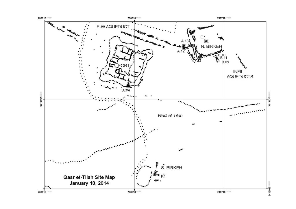
Possibly the most important result from this year’s expedition is the creation of an extremely precise GPS base map of the site and its topographic surroundings (fig. 1). This mapping, done using Real Time Kinematic GPS, is by far the most accurate ever created of this site. This will enable the creation of a plan of the fort and a complete topographic profile of the site (important for understanding the water system). It also includes mapping of recent looting activity, which is currently a major problem for cultural resource management in Jordan (and the world). This accurate map of the illegal looting will help Jordanian authorities monitor the damage to this site in the future. The WAEP will continue to cooperate with the Jordanian Department of Antiquities on this and other efforts to protect and investigate Jordan’s rich cultural heritage. This season, we were also able to use these looters’ pits, one of which dug into the aqueduct structure at the base of the main reservoir, to “preview” the subsurface. By cleaning and straightening these pits, it became possible to see, for the first time, what must have been the main outflow portal of the main reservoir at the site, immediately on the alignment of the Wadi ‘Araba fault. This is an extremely important and serendipitous result, revealing the connection of the aqueduct running past the fort to the field system to the reservoir for the first time.

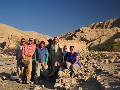
All in all, the 2014 season of the WAEP was extremely successful and we express our deepest gratitude to Dumbarton Oaks for the generous support of our efforts. Our team was led by Dr. Tina Niemi and John Rucker, a PhD student at UMKC; Abd Abueladas, also a PhD student at UMKC; Sean Polun, a PhD student at the University of Missouri Columbia; and four undergraduates: Robyn Daniels, Darrin Wilson, Tori Rose, and Janet Smith (fig. 2). We were assisted by Mr. Mohammad Thunaibat of the Aqaba Office of the Department of Antiquities. During the three weeks of excavation, we hired up to six local Bedouin as workmen. Preliminary results of this project were presented at the North Central sectional meeting of the Geological Society of America in April 2014. An interim report on the 2014 season is being prepared for publication in the Annual of the Department of Antiquities of Jordan. A more comprehensive monograph on the site as a whole is planned as well.